
|
Getting your Trinity Audio player ready...
|

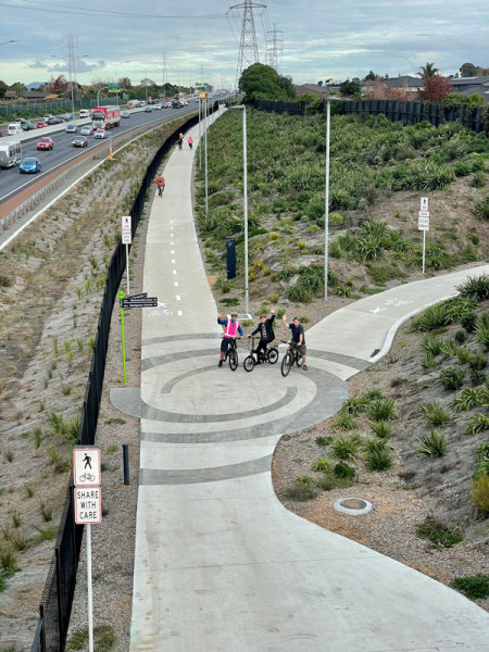
Adjacent to the Southern Motorway sits a popular sealed track called Southern Path.
This path is a great option for those looking to bike, walk or scooter between Takanini and Papakura while enjoying picturesque views of the Manukau Harbour.
The scenic route takes people along a 4.5km long route running beside the State Highway 1 corridor between Takanini and Papakura interchanges via two separate bridges crossing the harbour at Pahurehure Inlet. These two bridges restore public access to a peninsula at Takaanini Point for the first time since the adjacent motorway was constructed in the mid-1960s.
The 106.5 metre curved bridge at Pescara Point is shaped like an eel and includes a scale-type pattern within the balustrade and on the retaining wall approaches. Mana whenua gifted the name ‘Te Mara O Hine’ to the footbridge, which means ‘The Garden of Hine’. Hinewai was an ancestor of Waiohua who was locally renowned for her expansive gardens and for feeding the people.
Eight iwi artworks, led by iwi artist Henrietta Nicholas, were installed as part of the wider Southern Corridor Improvements (SCI) project, with four located along the Southern Path.
This is a shared path and can be busy, especially during the weekend, so be mindful of other users on foot or riding bikes and scooters. The path also links into the community with local connections at Brylee Drive, Conifer Grove reserve, and the esplanade reserves at the end of Gardone Terrace and Pescara Point.
The Southern Path opened back in 2021 as part of the SCI project. It will be extended a further 4km between the Papakura and Drury interchanges as part of the Papakura to Drury South project, which began construction in April 2021.